The weather in November was a tale of two different climates.
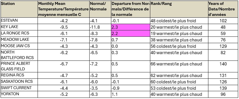
While temperatures for most weather stations in the province were at or close to their monthly average, except for Key Lake and La Ronge where they were two degrees warmer than normal, they should be taken with a grain of salt, says Environment Canada Meteorologist Danielle Desjardins. She says the first half was a continuation of the warm, above normal temperatures that we experience in September and October, then the snow and cold temperatures came in the second half of the month.
She also noted “overall for the month, southwestern Saskatchewan saw temperatures that were slightly below average and northeastern/north central Saskatchewan saw some temperatures above average.”


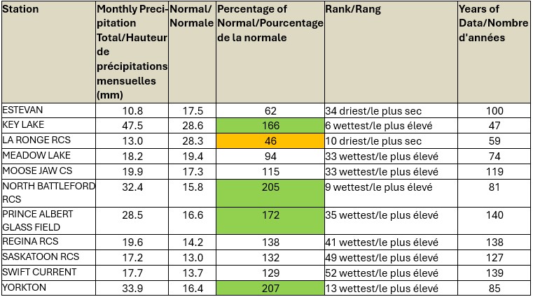
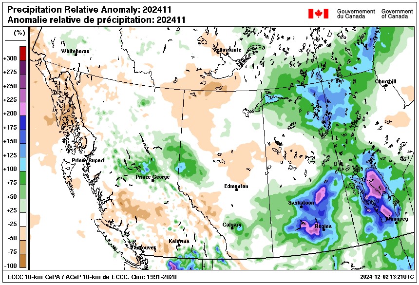
The snow arrived around November 18th and 19th and again on November 23rd and 24th – the latter dates which Desjardin said some areas got 30-40 cm of snow. The North Battleford and Yorkton areas recorded more than 200 per cent of their normal precipitation in November due to those storms. La Ronge was the driest at 46 per cent of normal precipitation, Estevan and Meadow Lake were below average, and Moose Jaw, Regina, Saskatoon, and Swift Current were slightly above average.
“Hopefully come spring time it won’t all melt at once and its a slower melt so that the ground can absorb more of the moisture.” Desjardins said.


